In 2006 Amazon introduced me to the idea that you could deploy global infrastructure using web APIs. This was when web APIs went from the hobby level (ie. photos, social, links) workbench, and became a tool I could actually use in my business toolbox. Web APIs weren’t just used or fun and games anymore, opening up my eyes to the endless possibilities when you make the web programmable using APIs.
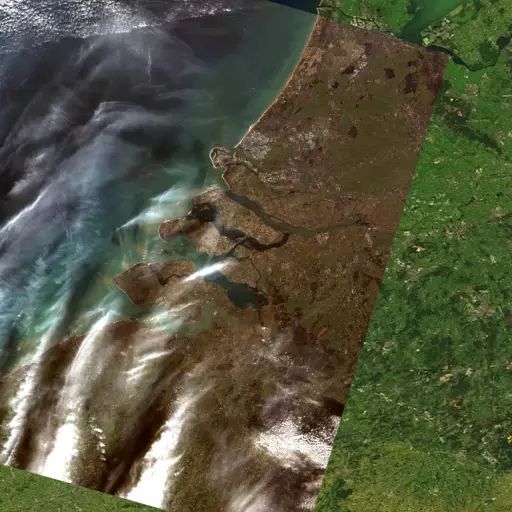
In 2016, I see a number of APIs show up on my monitoring radar, and honestly, most of them are not that notable–then you come across the solutions like the dead simple satellite imagery API from Astro Digital. I’m increasingly finding myself tracking on the collision APIs are having with our physical world, so I see a lot of interesting (and some not so) APIs, but I find the notion that you can get the latest picture of a specific place on earth is a pretty significant milestone for web APIs.
For me the Astro Digital satellite imagery API demonstrates for me the power of the Uniform Resource Locator (URL) and the Uniform Resource Identifier (URI)–I can get a snapshot of any location on earth, and manipulate my view of it using a single URI, from within any web or mobile application. This is just one of many APIs available to the average developer today, providing access to a wealth of high-value resources, that used to only be accessible to larger companies who could afford it.
I just wanted to pause for a moment, and take notice of some of the important resources that are being made available via APIs today, because I feel like the landscape is shifting pretty quickly with the introduction of these valuable resources. When companies small companies can work with the same resources as large enterprises and institutions, interesting things are possible.